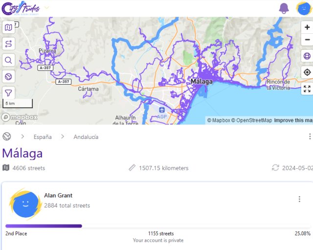
Walking Malaga's streets: one quarter completed
Today I noticed that according to the CityStrides website, I have walked or run 25% of the named streets in the municipality of Malaga. To be precise, I have covered X streets, with Y remaining. (The remaining streets are those that I have never visited at all, plus those that I have only partially completed).

I am a relatively recent convert to CityStrides, and to the "Every Single Street" or "Run Every Street" concept. I first became curious about it towards the end of last year, and uploaded all my past GPS traces. I am certainly not a hardcore member of the community, some of whom would probably be amused that anyone would publicise a paltry 25% completion rate. For one thing, I mainly walk, with only the occasional run. And I don't usually set out with racking up new streets as my main aim (although my natural curiosity does lead to me seeking out neighbourhoods I have never visited).
Often when walking around the city I am more focused on surveying for OpenStreetMap. These turn out to be nicely complementary activities. CityStrides is based entirely on OpenStreetMap (OSM) data, so using the tool often alerts me to things that need updating in OSM. If I can't complete a street in CityStrides because it is closed to the public, for example, it usually indicates that access tags need to be modified in OSM. I have also discovered a surprisingly high number of streets that consist at least partly of steps, but are mapped as normal streets.
Given that I have only hit the one quarter mark after more than 10 years living here, I don't ever expect to reach 100%. But it's fun to watch the number completed creeping upwards.
I know of two similar applications, both using OpenStreetMap data. StreetFerret, which I haven't used, looks to follow more or less the same approach as CityStrides. Wandrer takes a slightly different tack. Rather than counting named streets, it focuses on distance covered. It also recognises more rural tracks and footpaths, so is more likely to give credit for long hikes outside the city. I use it to track distance covered in the province of Malaga, which is a much larger area than the municipality as used by CityStrides. It tells me I have covered 1,320km in the province - still some way short of the total of more than 28,000km.
Published 2024-05-10